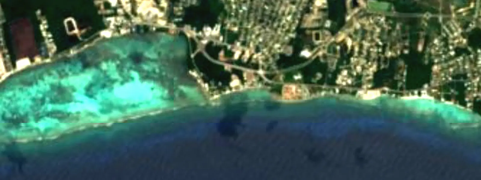
Beach
Prospect Beach
 Cayman Islands · Caribbean Sea
19.2734, -81.3348 · Prospect, 1 km
- 30°Sea · September
- 30°High · August
- 9.8 hSunshine · April
Your month at the beach
Prospect Beach in January
- 26°CAir, daytime high25°C at night
- 27°CSea temperature
- 7.2 hSunshine a day
- 9 daysRainy days in the month26 mm in total
- 25 km/hAverage wind
Averages for 1991–2020. A rainy day is a day with at least 1 mm of rain.
And a month earlier or later?
| December | January | February | |
|---|---|---|---|
| Air, daytime high | 27° | 26° | 26° |
| Sea | 28° | 27° | 27° |
| Sunshine a day | 7.2 h | 7.2 h | 8.4 h |
| Rainy days | 10 | 9 | 4 |
Prospect Beach in February
- 26°CAir, daytime high25°C at night
- 27°CSea temperature
- 8.4 hSunshine a day
- 4 daysRainy days in the month15 mm in total
- 23 km/hAverage wind
Averages for 1991–2020. A rainy day is a day with at least 1 mm of rain.
And a month earlier or later?
| January | February | March | |
|---|---|---|---|
| Air, daytime high | 26° | 26° | 27° |
| Sea | 27° | 27° | 27° |
| Sunshine a day | 7.2 h | 8.4 h | 9.1 h |
| Rainy days | 9 | 4 | 4 |
Prospect Beach in March
- 27°CAir, daytime high25°C at night
- 27°CSea temperature
- 9.1 hSunshine a day
- 4 daysRainy days in the month13 mm in total
- 23 km/hAverage wind
Averages for 1991–2020. A rainy day is a day with at least 1 mm of rain.
And a month earlier or later?
| February | March | April | |
|---|---|---|---|
| Air, daytime high | 26° | 27° | 27° |
| Sea | 27° | 27° | 27° |
| Sunshine a day | 8.4 h | 9.1 h | 9.8 h |
| Rainy days | 4 | 4 | 4 |
Prospect Beach in April
- 27°CAir, daytime high26°C at night
- 27°CSea temperature
- 9.8 hSunshine a day
- 4 daysRainy days in the month14 mm in total
- 20 km/hAverage wind
Averages for 1991–2020. A rainy day is a day with at least 1 mm of rain.
And a month earlier or later?
| March | April | May | |
|---|---|---|---|
| Air, daytime high | 27° | 27° | 28° |
| Sea | 27° | 27° | 28° |
| Sunshine a day | 9.1 h | 9.8 h | 8.7 h |
| Rainy days | 4 | 4 | 14 |
Prospect Beach in May
- 28°CAir, daytime high27°C at night
- 28°CSea temperature
- 8.7 hSunshine a day
- 14 daysRainy days in the month66 mm in total
- 20 km/hAverage wind
Averages for 1991–2020. A rainy day is a day with at least 1 mm of rain.
And a month earlier or later?
| April | May | June | |
|---|---|---|---|
| Air, daytime high | 27° | 28° | 29° |
| Sea | 27° | 28° | 29° |
| Sunshine a day | 9.8 h | 8.7 h | 7.9 h |
| Rainy days | 4 | 14 | 21 |
Prospect Beach in June
- 29°CAir, daytime high28°C at night
- 29°CSea temperature
- 7.9 hSunshine a day
- 21 daysRainy days in the month94 mm in total
- 21 km/hAverage wind
Averages for 1991–2020. A rainy day is a day with at least 1 mm of rain.
And a month earlier or later?
| May | June | July | |
|---|---|---|---|
| Air, daytime high | 28° | 29° | 29° |
| Sea | 28° | 29° | 29° |
| Sunshine a day | 8.7 h | 7.9 h | 8.8 h |
| Rainy days | 14 | 21 | 21 |
Prospect Beach in July
- 29°CAir, daytime high29°C at night
- 29°CSea temperature
- 8.8 hSunshine a day
- 21 daysRainy days in the month62 mm in total
- 19 km/hAverage wind
Averages for 1991–2020. A rainy day is a day with at least 1 mm of rain.
And a month earlier or later?
| June | July | August | |
|---|---|---|---|
| Air, daytime high | 29° | 29° | 30° |
| Sea | 29° | 29° | 30° |
| Sunshine a day | 7.9 h | 8.8 h | 8.5 h |
| Rainy days | 21 | 21 | 22 |
Prospect Beach in August
- 30°CAir, daytime high29°C at night
- 30°CSea temperature
- 8.5 hSunshine a day
- 22 daysRainy days in the month81 mm in total
- 18 km/hAverage wind
Averages for 1991–2020. A rainy day is a day with at least 1 mm of rain.
And a month earlier or later?
| July | August | September | |
|---|---|---|---|
| Air, daytime high | 29° | 30° | 30° |
| Sea | 29° | 30° | 30° |
| Sunshine a day | 8.8 h | 8.5 h | 7.8 h |
| Rainy days | 21 | 22 | 25 |
Prospect Beach in September
- 30°CAir, daytime high29°C at night
- 30°CSea temperature
- 7.8 hSunshine a day
- 25 daysRainy days in the month105 mm in total
- 17 km/hAverage wind
Averages for 1991–2020. A rainy day is a day with at least 1 mm of rain.
And a month earlier or later?
| August | September | October | |
|---|---|---|---|
| Air, daytime high | 30° | 30° | 29° |
| Sea | 30° | 30° | 29° |
| Sunshine a day | 8.5 h | 7.8 h | 6.6 h |
| Rainy days | 22 | 25 | 24 |
Prospect Beach in October
- 29°CAir, daytime high28°C at night
- 29°CSea temperature
- 6.6 hSunshine a day
- 24 daysRainy days in the month154 mm in total
- 20 km/hAverage wind
Averages for 1991–2020. A rainy day is a day with at least 1 mm of rain.
And a month earlier or later?
| September | October | November | |
|---|---|---|---|
| Air, daytime high | 30° | 29° | 28° |
| Sea | 30° | 29° | 28° |
| Sunshine a day | 7.8 h | 6.6 h | 6.8 h |
| Rainy days | 25 | 24 | 14 |
Prospect Beach in November
- 28°CAir, daytime high27°C at night
- 28°CSea temperature
- 6.8 hSunshine a day
- 14 daysRainy days in the month88 mm in total
- 25 km/hAverage wind
Averages for 1991–2020. A rainy day is a day with at least 1 mm of rain.
And a month earlier or later?
| October | November | December | |
|---|---|---|---|
| Air, daytime high | 29° | 28° | 27° |
| Sea | 29° | 28° | 28° |
| Sunshine a day | 6.6 h | 6.8 h | 7.2 h |
| Rainy days | 24 | 14 | 10 |
Prospect Beach in December
- 27°CAir, daytime high26°C at night
- 28°CSea temperature
- 7.2 hSunshine a day
- 10 daysRainy days in the month39 mm in total
- 25 km/hAverage wind
Averages for 1991–2020. A rainy day is a day with at least 1 mm of rain.
And a month earlier or later?
| November | December | January | |
|---|---|---|---|
| Air, daytime high | 28° | 27° | 26° |
| Sea | 28° | 28° | 27° |
| Sunshine a day | 6.8 h | 7.2 h | 7.2 h |
| Rainy days | 14 | 10 | 9 |
Warmest sea of the year: September (29.7 °C) · most sunshine: April (9.8 h a day).
The beach itself
- 16Places to stay within 5 kmHotels, guest houses, apartments and campsites · OpenStreetMap Places to stay near Prospect Beach
- 3 kmAirport: Owen Roberts International Airport (GCM)In a straight line; by road it is further Car hire at GCM airport (George Town)
No reliable information yet on: bathing water quality, wheelchair access, lifeguards.
Some links above are affiliate links: if you book through them we may earn a commission, at no extra cost to you. It never changes what the data on this page says.
January from 2020 to 2025
In January 2025 the sea averaged 27.6 °C — 0.7 °C above the 1991–2020 average.
1991–2020 average: 26.9 °C
1991–2020 average: 26.2 °C
Each bar is one year. Above the dashed line (the 1991–2020 average), that month was warmer than usual; below it, cooler.
February from 2020 to 2025
In February 2025 the sea averaged 27.5 °C — 0.9 °C above the 1991–2020 average.
1991–2020 average: 26.6 °C
1991–2020 average: 26.3 °C
Each bar is one year. Above the dashed line (the 1991–2020 average), that month was warmer than usual; below it, cooler.
March from 2020 to 2025
In March 2025 the sea averaged 27.5 °C — 0.8 °C above the 1991–2020 average.
1991–2020 average: 26.7 °C
1991–2020 average: 26.6 °C
Each bar is one year. Above the dashed line (the 1991–2020 average), that month was warmer than usual; below it, cooler.
April from 2020 to 2025
In April 2025 the sea averaged 27.7 °C — 0.4 °C above the 1991–2020 average.
1991–2020 average: 27.3 °C
1991–2020 average: 27.4 °C
Each bar is one year. Above the dashed line (the 1991–2020 average), that month was warmer than usual; below it, cooler.
May from 2020 to 2025
In May 2025 the sea averaged 28.7 °C — 0.6 °C above the 1991–2020 average.
1991–2020 average: 28.1 °C
1991–2020 average: 28.2 °C
Each bar is one year. Above the dashed line (the 1991–2020 average), that month was warmer than usual; below it, cooler.
June from 2020 to 2025
In June 2025 the sea averaged 29.3 °C — 0.7 °C above the 1991–2020 average.
1991–2020 average: 28.6 °C
1991–2020 average: 28.8 °C
Each bar is one year. Above the dashed line (the 1991–2020 average), that month was warmer than usual; below it, cooler.
July from 2020 to 2025
In July 2025 the sea averaged 29.7 °C — 0.5 °C above the 1991–2020 average.
1991–2020 average: 29.2 °C
1991–2020 average: 29.4 °C
Each bar is one year. Above the dashed line (the 1991–2020 average), that month was warmer than usual; below it, cooler.
August from 2020 to 2025
In August 2025 the sea averaged 30.5 °C — 0.9 °C above the 1991–2020 average.
1991–2020 average: 29.6 °C
1991–2020 average: 29.8 °C
Each bar is one year. Above the dashed line (the 1991–2020 average), that month was warmer than usual; below it, cooler.
September from 2020 to 2025
In September 2025 the sea averaged 30.7 °C — 1.0 °C above the 1991–2020 average.
1991–2020 average: 29.7 °C
1991–2020 average: 29.6 °C
Each bar is one year. Above the dashed line (the 1991–2020 average), that month was warmer than usual; below it, cooler.
October from 2020 to 2025
In October 2025 the sea averaged 30.2 °C — 1.0 °C above the 1991–2020 average.
1991–2020 average: 29.2 °C
1991–2020 average: 29.1 °C
Each bar is one year. Above the dashed line (the 1991–2020 average), that month was warmer than usual; below it, cooler.
November from 2020 to 2025
In November 2025 the sea averaged 29.1 °C — 0.7 °C above the 1991–2020 average.
1991–2020 average: 28.4 °C
1991–2020 average: 27.9 °C
Each bar is one year. Above the dashed line (the 1991–2020 average), that month was warmer than usual; below it, cooler.
December from 2020 to 2025
In December 2025 the sea averaged 28.4 °C — 0.8 °C above the 1991–2020 average.
1991–2020 average: 27.6 °C
1991–2020 average: 27.0 °C
Each bar is one year. Above the dashed line (the 1991–2020 average), that month was warmer than usual; below it, cooler.
When to go
1991–2020 averagesThe year at a glance
- Jan27°7 h26 mm
- Feb27°8 h15 mm
- Mar27°9 h13 mm
- Apr27°10 h14 mm
- May28°9 h66 mm
- Jun29°8 h94 mm
- Jul29°9 h62 mm
- Aug30°8 h81 mm
- Sep30°8 h105 mm
- Oct29°7 h154 mm
- Nov28°7 h88 mm
- Dec28°7 h39 mm
Each card is a month. The colour is the sea temperature, on the same scale as the map; in bold, the two best months for each.
Sea temperature
1991–2020 averagesClimate through the year
1991–2020 averagesRain
Sunshine
Sunshine hours are estimated from measured solar radiation, not observed directly.
Month by month
1991–2020 averagesEvery month at Prospect Beach: air, sea, rain and sunshine. Averages for 1991–2020.
| Month | High°C | Low°C | Sea°C | Rainmm | Rainy daysdays | Sunshineh/day | Windkm/h |
|---|---|---|---|---|---|---|---|
| January | 26 | 25 | 27 | 26 | 9 | 7.2 | 25 |
| February | 26 | 25 | 27 | 15 | 4 | 8.4 | 23 |
| March | 27 | 25 | 27 | 13 | 4 | 9.1 | 23 |
| April | 27 | 26 | 27 | 14 | 4 | 9.8 | 20 |
| May | 28 | 27 | 28 | 66 | 14 | 8.7 | 20 |
| June | 29 | 28 | 29 | 94 | 21 | 7.9 | 21 |
| July | 29 | 29 | 29 | 62 | 21 | 8.8 | 19 |
| August | 30 | 29 | 30 | 81 | 22 | 8.5 | 18 |
| Septemberwarmest sea | 30 | 29 | 30 | 105 | 25 | 7.8 | 17 |
| October | 29 | 28 | 29 | 154 | 24 | 6.6 | 20 |
| November | 28 | 27 | 28 | 88 | 14 | 6.8 | 25 |
| December | 27 | 26 | 28 | 39 | 10 | 7.2 | 25 |
Swipe sideways to see the other columns.
Plan your trip
Some links above are affiliate links: if you book through them we may earn a commission, at no extra cost to you. It never changes what the data on this page says.
In our other atlases
What else is near Prospect Beach.
The island, the river, the lakes, caves, mountains and viewpoints around this beach, and its forests, birds and night sky, in the family's other atlases.

Figures from the sister sites' databases (Wikidata, HydroATLAS, GeoNames, OpenStreetMap, GBIF). Links open when each site is online.
About these numbers
Averages are for 1991–2020; the recent years (2020–2025) are what actually happened. Neither is today's weather.
| What | Where it comes from | Nearest measurement |
|---|---|---|
| Air, rain and sunshine | NASA POWER | 27 km away |
| Sea temperature | NOAA OISST v2.1, 1991–2020 | 12 km away |
| 2020–2025, month by month | NASA POWER · NOAA OISST v2.1 | 27 km away |
| Lifeguards and places to stay | OpenStreetMap | within 1–5 km |
| Nearest airport | OurAirports | straight-line distance |
| Image at the top | Sentinel-2 cloudless (EOX) | at this spot |